Israeli military publishes map of new deployment line in Lebanon, bringing dozens of villages under its control
Web desk
|
20 Apr 2026
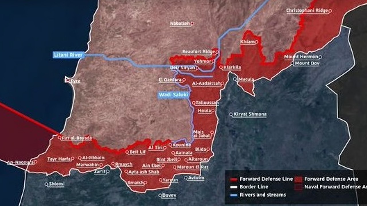
For the first time ever, the Israeli army released a map of their new deployment line in Lebanon on Sunday, putting under their control several dozen Lebanese villages that are mostly deserted.
There was no immediate reaction either from the Lebanese government or from Hezbollah. The Israeli and Lebanese governments reached an agreement earlier this week for a ceasefire in the conflict between Israel and Hezbollah.
This new agreement comes as a result of the first talks in many years between Israel and Lebanon, which took place on April 14, with the intention of facilitating further talks between the US and Iran.
The deployment line in the map stretches east to west, 5-10 kilometers deep into Lebanese soil from the border, where Israel intends to establish a buffer zone.
The Israeli military has wiped out some of the Lebanese villages in the region, citing as a reason its need to defend northern Israeli cities from Hezbollah threats.
“The Israeli Navy forces, along with five divisions, are concurrently operating in the south of the forward defense line in southern Lebanon for the purpose of dismantling Hezbollah infrastructure sites and deterring the communities in northern Israel from any threat,” the military said in a statement released with the map
When asked if people affected by the Israeli strikes will be allowed to return to their settlements, the Israeli military refused to make comments.
Lebanese citizens have access to some of the villages lying within or outside the Israeli boundary, but not the ones which lie south of the demarcated line.


Comments
0 comment